
When Captain
George Vancouver and his two ships, the Discovery
and the Chatham
set out to map the coast of British
Columbia

The big ships
anchored in strategic places and smaller boats were sent to search the bays and
channels.

Several times
the big ships ended up in the rocks and frequently the boat trips were of many
days duration in very bad weather. Occasionally the crews rowed day and night and on more than one occasion, after a brush with the Indians, rowed for their
lives.
Their methods of
navigation included a compass and a marine chronometer: a clock accurate enough
to be used to determine longitude by the position of stars and the sun. The maps they produced were valuable
references for those who followed.
During our
little excursion up into Desolation Sound, Captain Jeffrey had many navigation
tools available.

He used a
library of maps he kept where they could be referenced…

...in an overhead
display in the pilot house. He was also in
constant radio contact with water craft around him and the marine officials on
the shore.

He used
electronic aids such as the global navigation satellite systems to find his way
around shallow water, hidden rocks and narrow channels.

Captain Jeffrey
explained the knowledge of the tides is especially important when navigating
between Vancouver Island and mainland British
Columbia

Big tides from
the Pacific Ocean ebb and flow around both
sides of the huge land mass causing dramatic turbulence, also know as tidal
rapids, as the water forces its way through the narrow passages. To pass safely, a boater needs to know when
slack tide happens. This is a pause
between flood and ebb tide---sort of like the moment between breathing in and
breathing out. This break only lasts a few minutes so timing is essential.
Jeffrey was so
good at arriving at slack tide that we seldom witnessed the turbulence and
strong whirlpools which can swamp a small boat.

When we arrived
at a place such as Dodd Narrows, often there were boats lined up waiting for the moment of
quiet between the ebb and flow.
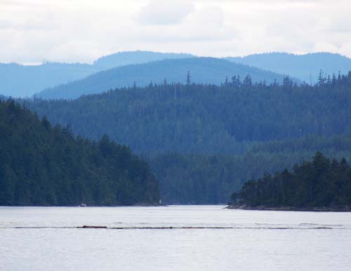
A tangled anchor
chain put us a little late at Surge
Narrows

Even though we
could see the disturbances caused by the surge of water, our captain skillfully
guided our craft around the hazards. I
was almost disappointed we missed out on any kind of adventure.
My video of Captain Jeffrey at the wheel in the pilot house of the David B.

6 comments:
I'm continuing to enjoy your trip VERY much!!
Amazing how brave the ancient mariners were...can you imagine catching your first glimpse of an unknown land? Awesome photos and story, Leenie. As always, a pure delight to drop in here. Especially on a rainy Saturday afternoon and a fresh cup of tea at hand. :)
Great post! Talented man with special skills that must be a joy to see put into practice. I'm glad you made the video so we could see valued learning and experience in action. You were definitely in safe hands there!
Wow, that would have been very exciting if you got caught in one of those tides...in a bad way most certainly.
Great shots, and I too am enjoying the trip.
Jen
Tidal rapids? Who knew? Not me, that's for sure. I'm a confirmed landlubber. No seagoing for me. The only time I came close was a trip on a ferry from Ketchikan to Juneau. Since I could see land the whole time, it didn't count as the ocean. In my mind, anyway.
Leenie, you are a talented photographer as a sort of documentary film.
('∇^d) wonderful!
Post a Comment