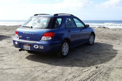
Instead of returning across the Oregon desert I drove north up the coast. One of the attractions there is the wreck of the Peter Iredale. It was a steel sailing ship which was grounded on the sand at the mouth of the Columbia River during a storm in 1906.
During World War II Japanese submarines fired several shells at the wreck thinking it was part of Fort Stevens just up the coast. No damage was done to the ship or the fort and Fort Stevens didn’t return fire so as not to reveal their location.
After a few photos I continued on up the beach.
Fort Stevens was built during the Civil War 1864-1865. It was an active military post until 1947 and is now on the National Register of Historic Places.
The defensive walls around the fort give a great view of the shipping traffic moving between the Pacific Ocean and the Columbia River.
It was only a short drive to Astoria, Oregon where I made a stop at the Astoria Column, a 125 foot high tower on the hill overlooking the city and the river. It is painted with murals commemorating the history of the area.
I drove my little Subaru into the traffic crossing the Astoria-Megler Bridge and took the 4 mile trip across the river to Washington State.
The last time I visited this part of the country we missed Cape Disappointment Lighthouse. I made the steep hike up the trail to the lighthouse which has a view of the 6-mile-wide mouth of the river. The U.S. Coast Guard keeps watch there over an area known worldwide for rough sea conditions. Nearby is the Lewis and Clark Interpretive Center which marks where The Corps of Discovery finally reached their goal.
Due to the Eagle Creek fire near the town of Cascade Locks, all traffic was closed on Interstate 84. So I had to take the winding two lane Highway 14 along the Washington side of the river.
The firefighters were trying to slow the progress of the wildfire but the whole river canyon was choked with smoke. The fire started September 5 and with the dry conditions and wind it continued to grow and spread. It wasn’t contained until November and by then had burned over 48 thousand acres.
It took over an hour of driving east to get clear of the smoke and ashes in the air.
I stopped by the Maryhill Museum of Art. It sits high above the river on the Washington side and was originally supposed to be a mansion where the entrepreneur Sam Hill and his wife would entertain guests.
Among other things, it houses a nice cross section of sculpture and art from European and United States artists plus a display of Native American art.
Three miles away on the bluff is a replica of Stonehenge. It was also commissioned by Sam Hill as a memorial to people who had died in World War II. This was one of the places to be during the 2017 Solar Eclipse.
Alas, I finally had to leave the green forests, orchards and vineyards of the coast and drive on east across the high deserts of Oregon and Idaho to return home. Total miles: 2,098.


4 comments:
I enjoyed your photos Leenie. I grew up on the Wa coast and we used to go to Seaside for vacation when i was a kid. We took a ferry across to Astoria before the bridge opened in 1966. It is quite impressive!
Thank you for taking us on this wonderful tour!!
This brought back memories of the fall/winter of 1988-1989, when I was a student at a Bible school in Cannon Beach OR. We took some weekend day trips to Fort Stevens and to Astoria, where we climbed the column and looked out over that bridge into WA. Thanks for the pictures!
Ꮐreat post.
Post a Comment